GIS EEO · MOBILE + CENTRAL GIS

GIS EEOAccurate location. Faster fieldwork. Fewer losses.

Field teams carry the map, the route and the right asset data on their phone. Verified information returns to one central GIS system for control, planning and the next field visit.

Actual GIS EEO start screen with its network identity
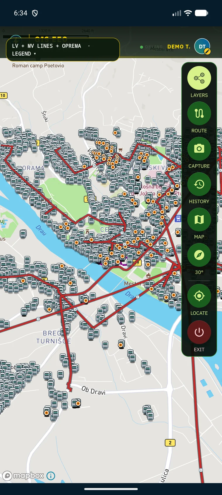
Actual GIS EEO map showing the Ptuj network demo
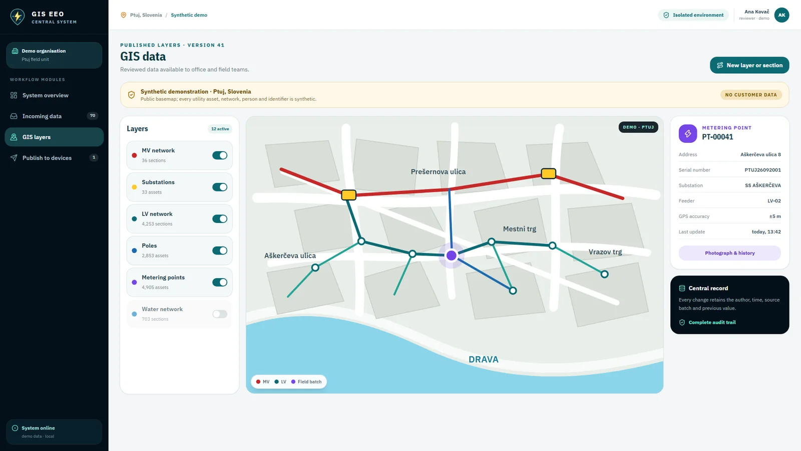
Central GIS system with the Ptuj demonstration network

ELECTRICITY DISTRIBUTION

Know where every metering point is.

Precisely linking the customer, meter and location makes reading faster, supports better control and provides a more reliable basis for reducing operational and commercial losses. The map guides the crew to a metering point, customer, transformer station, overhead line or low-voltage section.

  1. Locatethe customer, meter and network asset
  2. Navigateto the exact field location without searching
  3. Returna photo, coordinates and verified field data
THE NETWORK ON THE PHONE

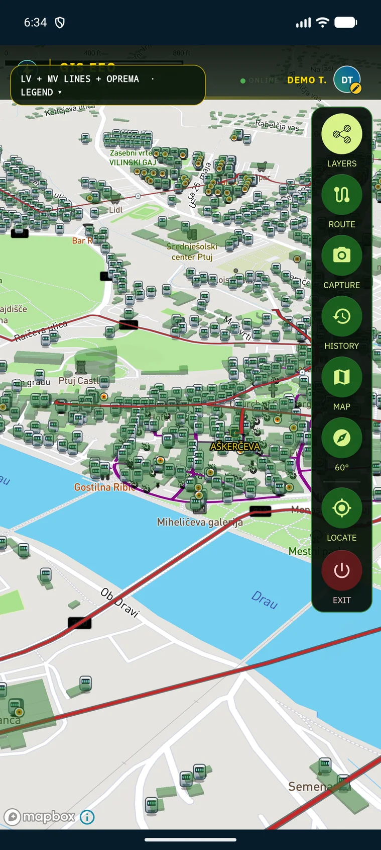
The whole network in the operator's hand.

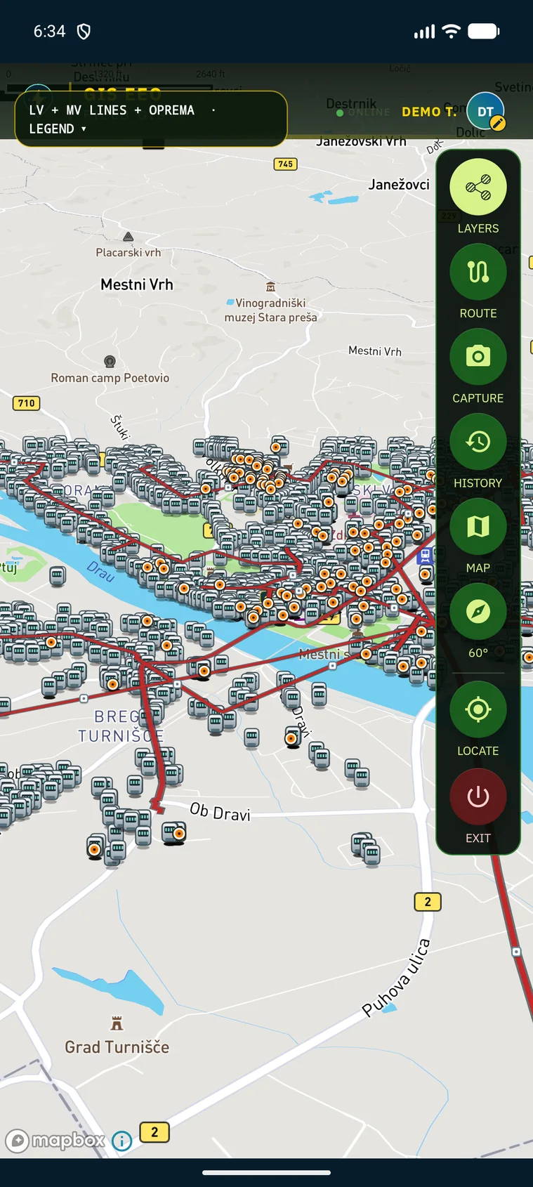
Overhead lines, transformer substations, the low-voltage network and every metering point are drawn on the same map. The view tilts and zooms, so the crew reads the network the way it stands in the street.

Medium-voltage lines, substations and metering points across the whole Ptuj demo area
Overhead lines and substationsThe medium-voltage network runs across the town, with every substation and its metering points on the same screen.
Low-voltage network and metering points zoomed in on a Ptuj neighbourhood
Low-voltage network up closeZoomed in, the low-voltage network, poles and individual metering points separate clearly, street by street.
Tilted three-dimensional view of the Ptuj network
Tilted 3D viewThe tilted view keeps the direction of travel in front of the crew, which helps when the line follows the road.

FROM FIELD TO CENTRAL GIS

One working day. Twelve connected steps.

Every screen below is the real application. The sequence follows one working day: from sign-in and the route, through the photograph and the form, to the published layer that returns to every field device.

01

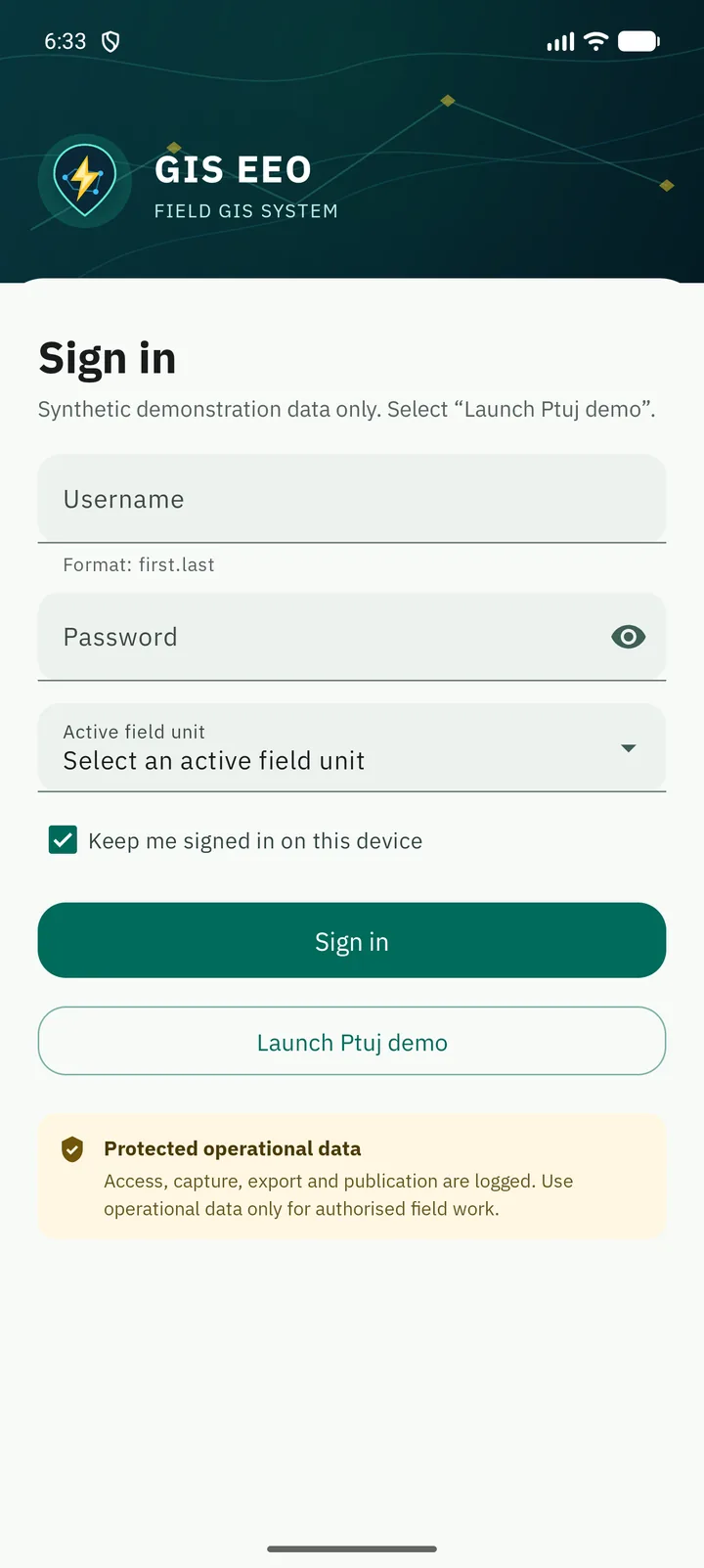
Sign in and receive the work area

Access is controlled. After sign-in the operator gets the right organisation, role and field unit, and every capture, export and publication stays logged.

Actual GIS EEO sign-in screen
ACCESS · ROLE
02

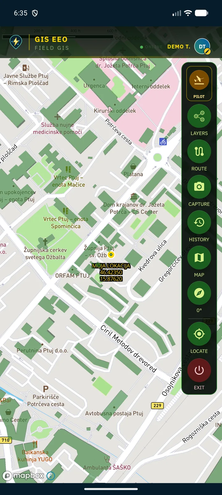
Open the field map

The assigned area and its records open on the map. The downloaded package stays usable where the signal is weak or absent.

Actual GIS EEO map after loading the Ptuj field package
MAP · OFFLINE PACKAGE
03

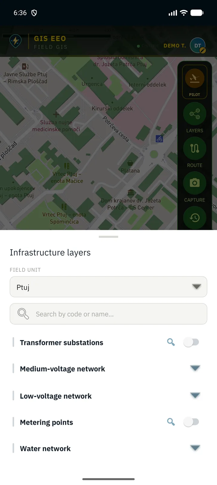
Turn on the network layers

Medium-voltage and low-voltage networks, transformer substations, poles, metering points and the water network — each layer is switched on when the crew needs it.

Actual GIS EEO infrastructure layer panel
LAYERS · NETWORK
04

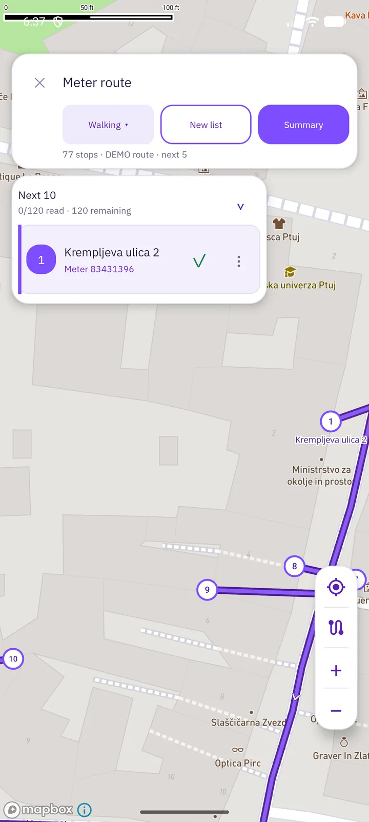
Plan the reading route

A list of metering points becomes an ordered route, on foot or by vehicle, with progress counted as the work goes on.

Actual GIS EEO meter route with ordered stops
ROUTE · 120 METERS
05

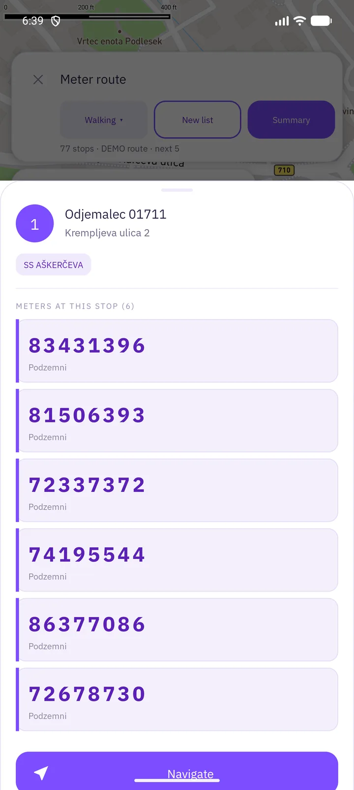
Navigate to the next stop

The crew sees which meters belong to the stop, then starts navigation and arrives without searching for the address.

Actual GIS EEO route stop with the meters at that address
STOP · NAVIGATE
06

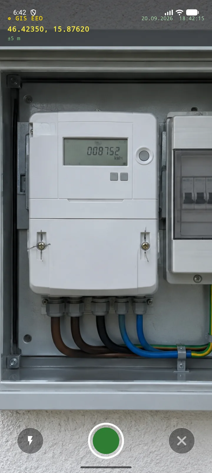
Photograph the asset

The camera records the state of the asset with coordinates and time stamped on the image, so the evidence cannot be detached from the location.

Actual GIS EEO camera view with a metering cabinet
CAMERA · EVIDENCE
07

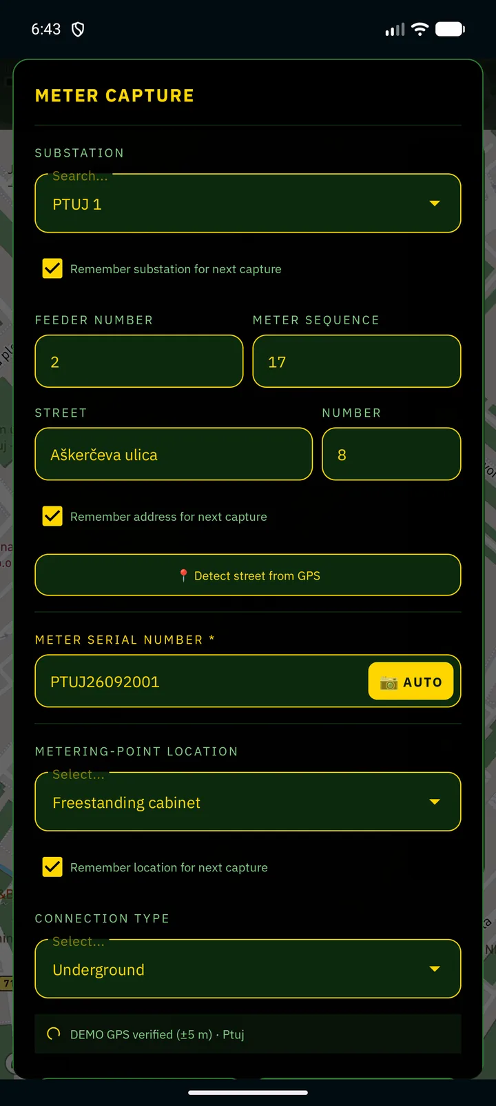
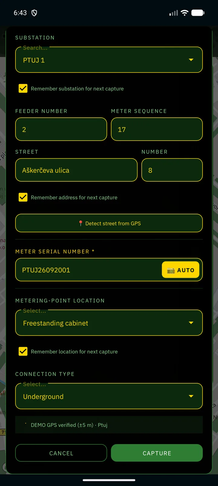
Fill the form for that asset

The form follows the asset: substation, feeder, address, metering-point location and connection type. The serial number is read from the plate by the camera.

Actual GIS EEO capture form for a metering point
FORM · SERIAL · OCR
08

Confirm the position and save

Before saving, the operator confirms the exact position of the asset. Accuracy is recorded with the entry, so office teams know how reliable it is.

Actual GIS EEO capture form ready to save with verified GPS
GPS ±5 m · SAVE
09

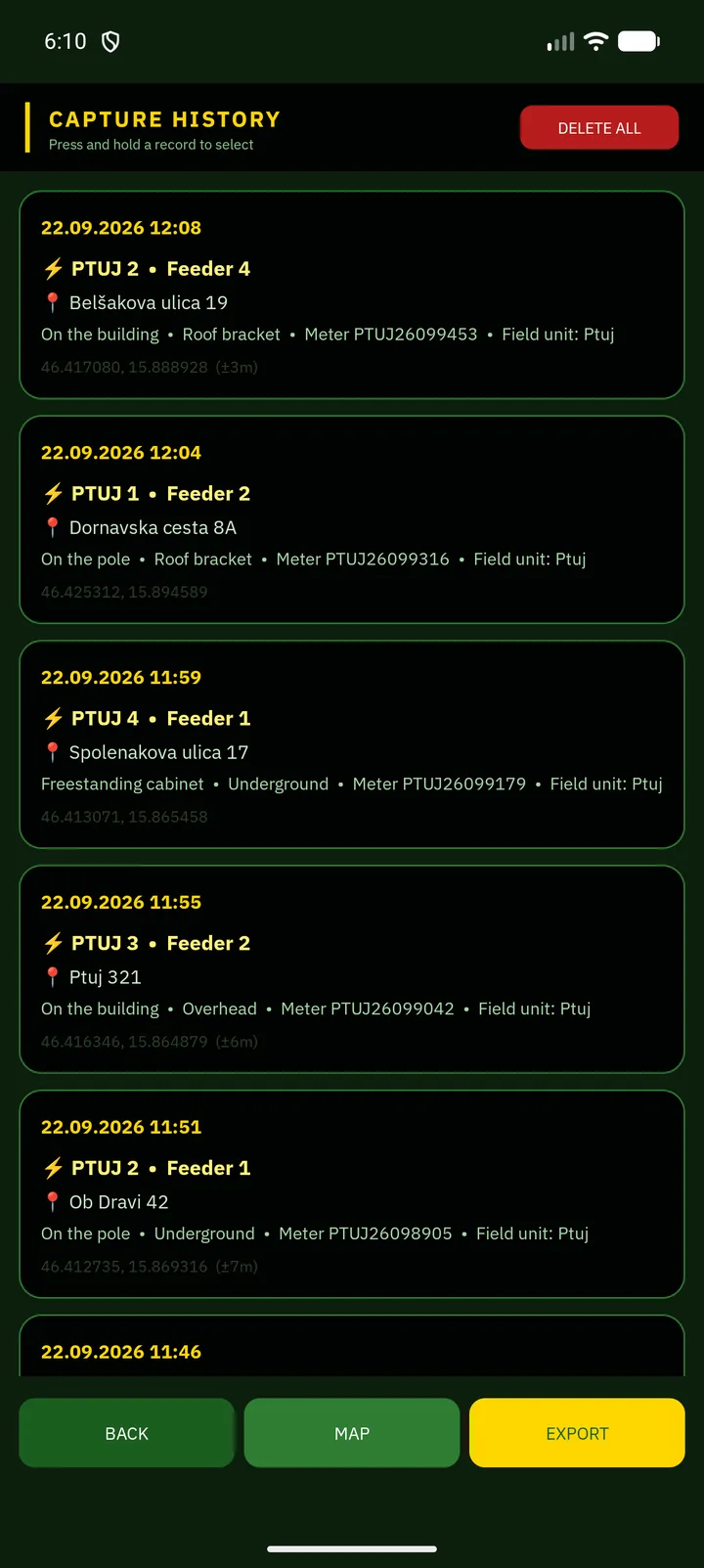
Send the batch from history

Captured records wait on the device. When the series is complete, one action exports it with all photographs attached.

Actual GIS EEO capture history ready for export
HISTORY · EXPORT
10

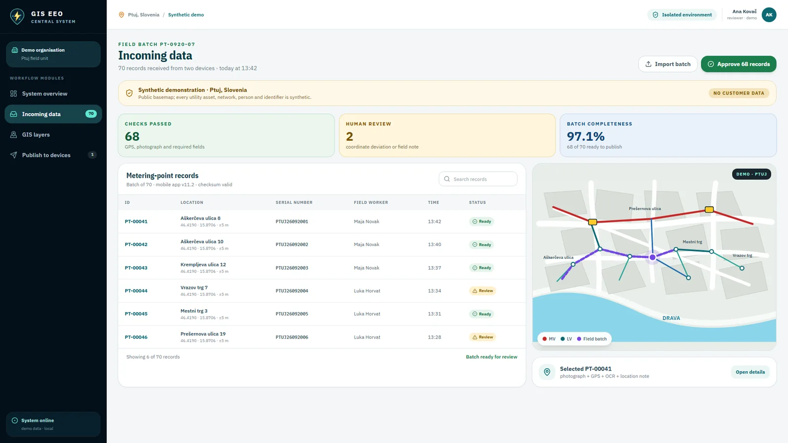
Receive the batch centrally

The office receives the field batch, sees who sent it and when, and the system checks coordinates, photographs and mandatory fields before anything is accepted.

Central system receiving a field batch of metering-point records
BATCH · CHECKS
11

Review it on the central map

Every record opens with its photograph, coordinates, serial number and history, and each change keeps its author and source batch.

Central system showing the reviewed Ptuj network data
REVIEW · AUDIT TRAIL
12

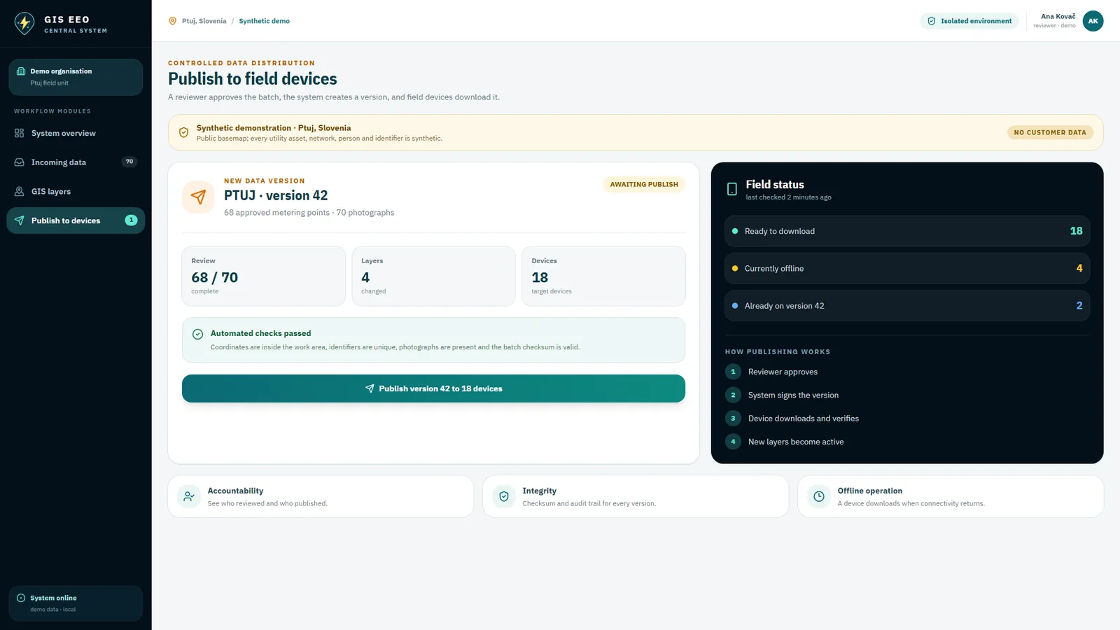
Publish it back to the field

The approved version becomes a new data layer and the devices download it. The next visit starts from the corrected map.

Central system publishing a new data version to field devices
PUBLISH · VERSION 42

CONFIGURED FOR THE SERVICE

One technology. A dedicated tool for every service.

This is not the same screen with a different colour. The photo subject, icons, map layers, mandatory fields and terminology are configured around the infrastructure each organisation operates.

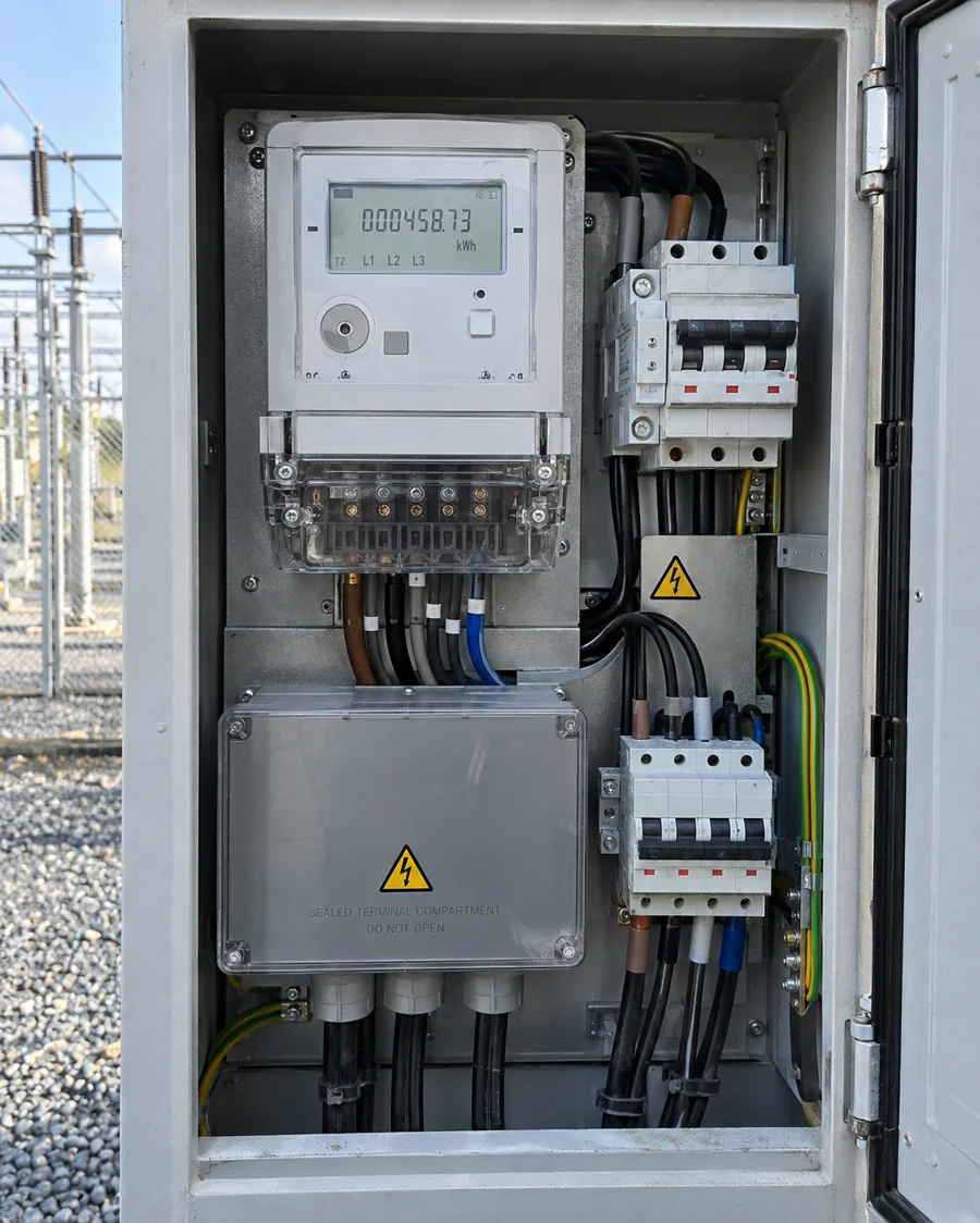
Field operator photographing an electricity meter

Electricity

From the consumer and meter to transformer stations, overhead lines and the low-voltage network. The crew sees the asset context before arriving and returns a traceable reading.

Metering point
MM-PT-1842
Reading
18,426 kWh
Coordinates
46.4196, 15.8692
Seal
Intact
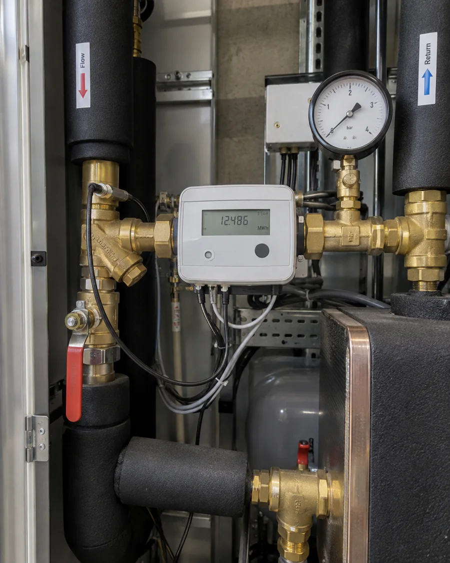
Field operator photographing a district heating meter

District heating

Photograph and register a heat meter in a building substation. The form follows heat-distribution terminology instead of electricity fields.

Substation
TP-031
Heat meter
6,842.7 MWh
Flow temperature
78.4 °C
Seal
Intact
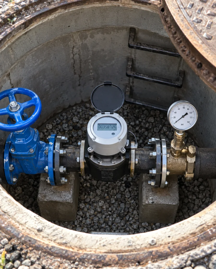
Field operator photographing a water meter in a chamber

Water utility

Find the exact meter chamber, document access and capture the reading in one visit. The central map receives a georeferenced field record.

Water meter
VD-008421
Reading
1,284.6 m³
Meter chamber
Dry
Access
Accessible
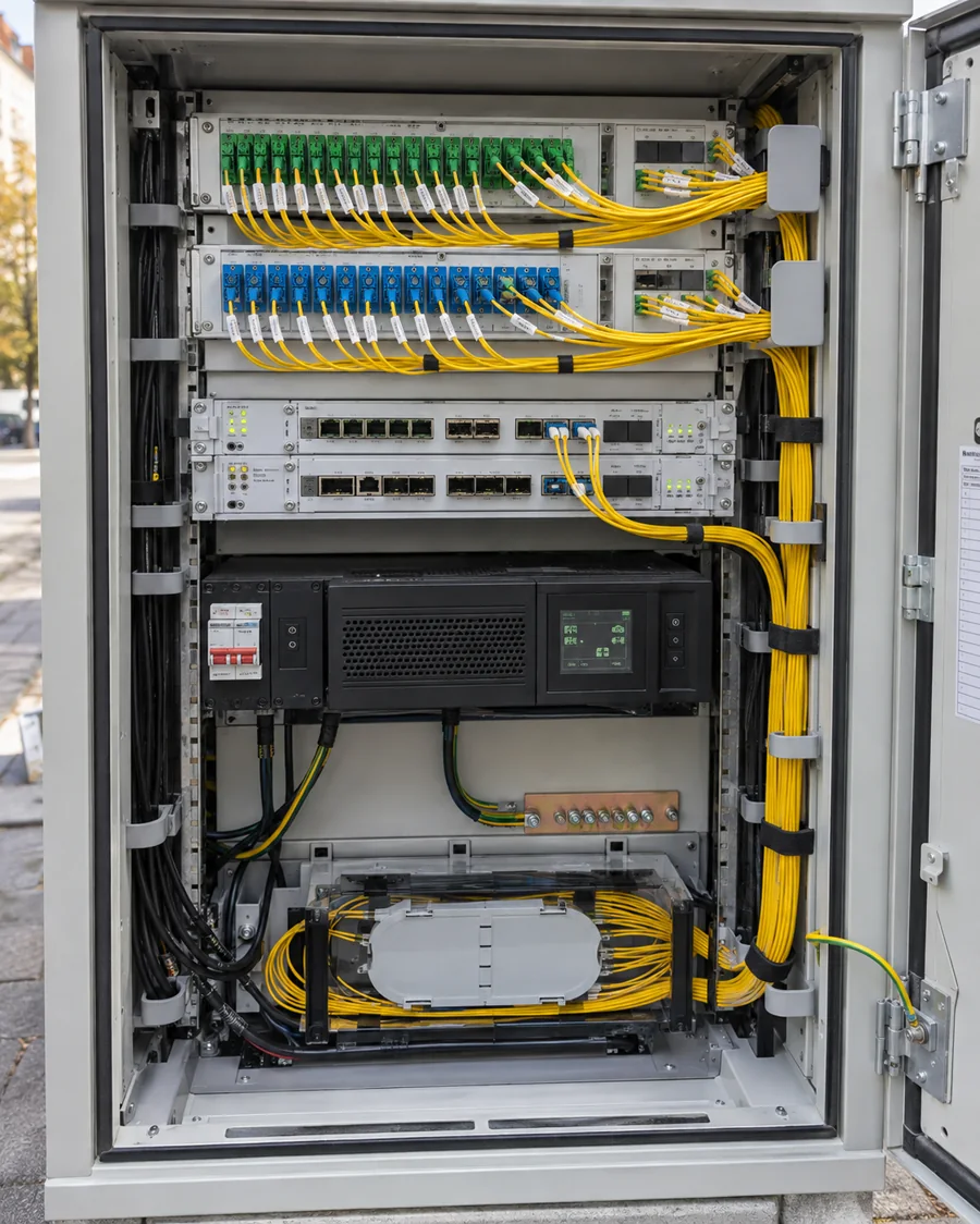
Telecom technician documenting an optical network cabinet

Telecom

Navigate to a cabinet, closure or customer connection and document the precise cable and port context required by the network team.

Cabinet
FTTC-PT-17
Cable
FO-24/12
Port
PON-08
Optical level
−18.7 dBm
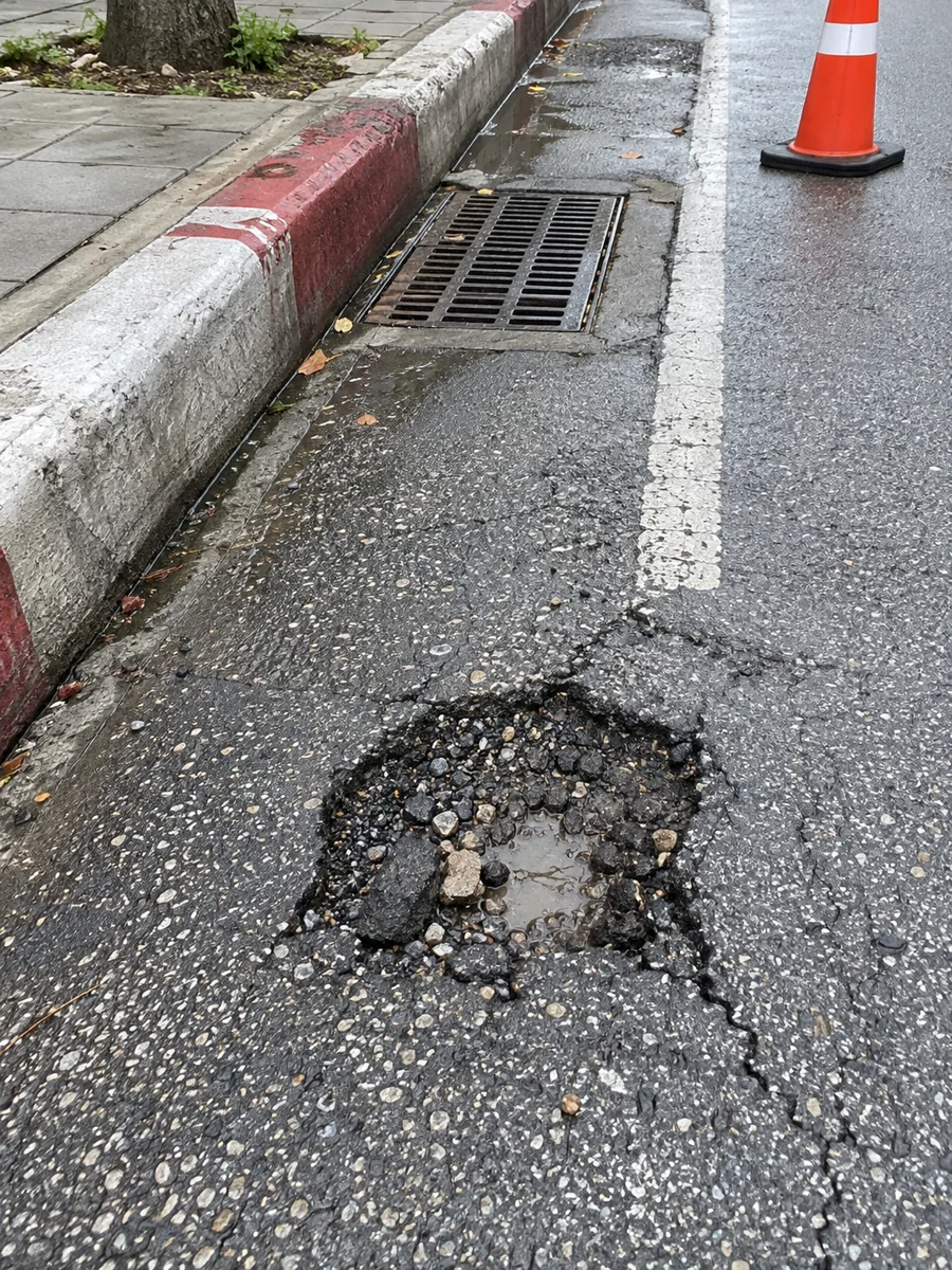
Road service employee photographing pavement damage

Roads

Record a road observation with its exact position, photograph and dimensions. The responsible team receives comparable, map-based information for prioritisation.

Road section
R3-710/04
Observation
Pothole
Dimensions
62 × 38 cm
Priority
High
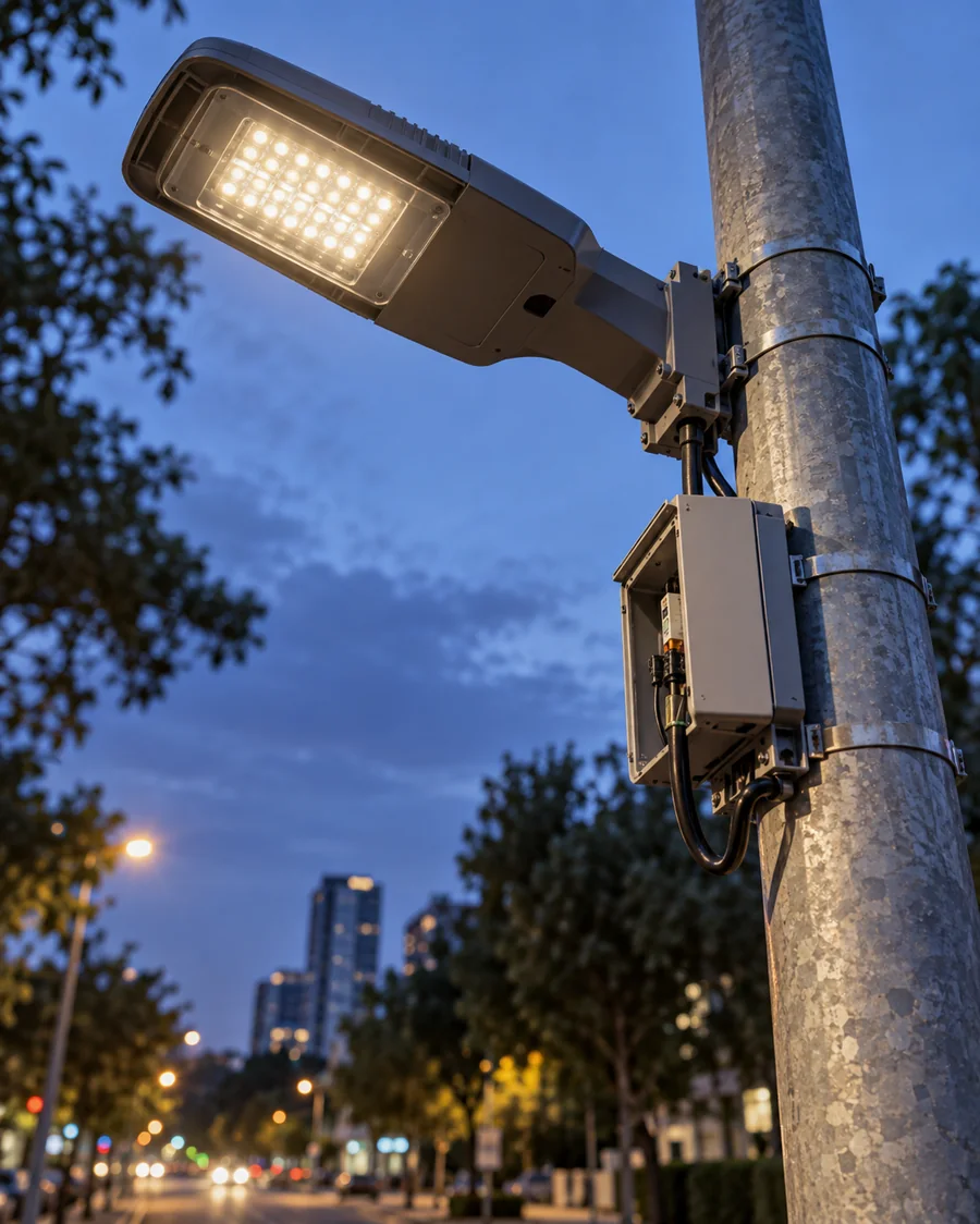
Field technician documenting a public-lighting pole

Public lighting

Every pole, luminaire and control cabinet gets a known position and its own field history, making inspections and route planning easier.

Pole
JR-2048
Luminaire
LED 48 W
Control cabinet
RO-JR-12
Record
Inspection saved
Municipal-services employee documenting a waste container

Municipal services

Map containers and collection points, document their condition and plan visits with reliable location and access information.

Collection point
KO-118
Container
1,100 l
Fill level
82%
Access
Clear

Every screen comes from the real GIS EEO product, shown here with a demonstration data set for the town of Ptuj.

Request a GIS EEO demonstration